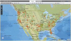
 A new interactive Firewise® Mapper (Beta version) using the ESRI ArcGIS Explorer Online platform is now available. This new tool was primarily designed to identify and locate recognized Firewise Communities/USA® sites throughout the nation. The user friendly interface lets you navigate around and zoom to a specific site and with the left click of the mouse additional information about a specific site can be accessed through a ‘pop-up’ window.