Burned Area Emergency Response (BAER)
Sequoia and Sierra National Forests Post-Fire BAER Assessment
Monday, October 26, 2015
BAER Information: (415) 881-1871
Safety Hazards Remains in Rough Burned Area
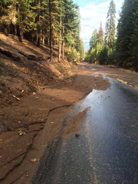
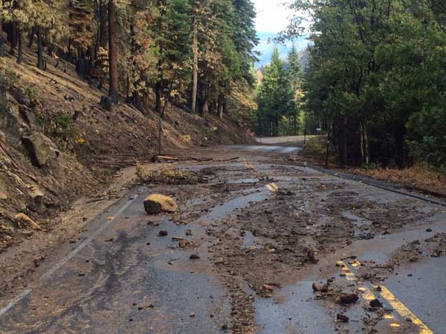
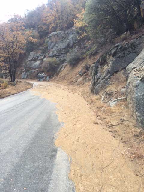
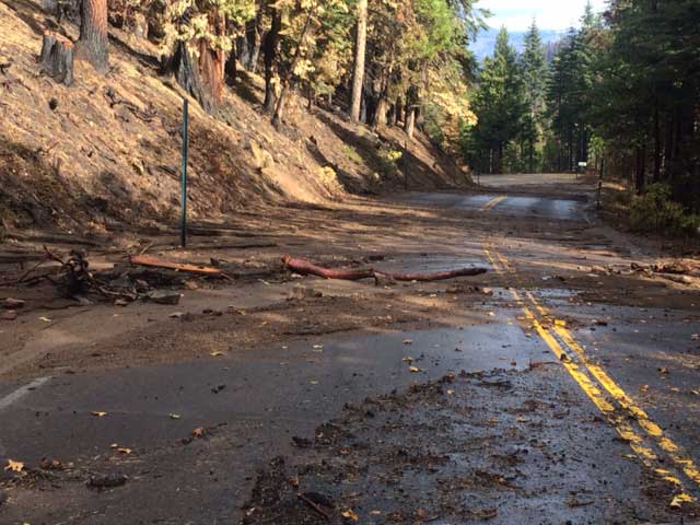
Photos from a October 2015 afternoon rain storm taken along Highway 180 from Cherry Gap to the 13S55 Forest Service road (Boole tree), and along Hume Lake Road:
The Rough Fire that burned within the Sierra and Sequoia National Forests, and the Kings Canyon National Park, resulted from lightning and serves as a reminder that Mother Nature and fire continue to play a major role in forest ecosystems.
SPECIAL NOTE: Everyone near and downstream from the Rough Fire burned areas should remain alert and stay updated on weather conditions that may result in heavy rains over the burn scar. Flash flooding may occur quickly during heavy rain events.
Current weather and emergency notifications can be found at the National Weather Service, San Joaquin Valley/Hanford Office (www.wrh.noaa.gov/hnx/) website.
Rough Post-Fire BAER Assessment information is available at http://inciweb.nwcg.gov/incident/4625/.
Natural processes also play a major role in forest recovery after a wildfire. However, there are certain actions to protect California watersheds that can be taken immediately to speed the recovery of the burned areas and reduce sediment and soil erosion that flow downstream from these burned areas during fall and winter rains.
Suppression repair is the first phase of recovery efforts to return the affected area to pre-fire conditions. Controlling erosion and run-off from fire suppression containment lines are high priorities for the Forest Service to ensure healthy watersheds.
Now that the Rough Fire is contained in the area where it burned onto the Hume Lake Ranger District in the Giant Sequoia National Monument, Sequoia National Forest (NF) and the current threat of fire is gone, there are still natural hazards in the burned area that will keep most of the District closed for public safety until spring. These hazards were assessed by Burned Area Emergency Response (BAER) teams as part of the second phase of wildfire recovery.
Two BAER teams were established by Forest Supervisors of the Sierra and Sequoia National Forests to survey National Forest System lands that burned within the Rough wildfire. BAER team surveys are rapid assessments of the burned areas (separate from fire suppression repair crews) that evaluate the burned watersheds and determine the potential for increased post-fire flooding, sediment flows, rock slides, and hazard trees.
When the first significant rain showers arrived on the Hume Lake Ranger District during the weekend of October 17, local Forest personnel were quickly out checking road conditions. As expected, areas were found with debris and mud flows across sections of roadway, similar to those seen in the pictures below along Highway 180 and the road to Hume Lake.
Recreation area opening procedures in the springtime typically require weeks of preparation by Forest employees before an area can be open to visitors. “With that in mind, and the normal recreation season ending in mid-November, I decided to keep these areas closed until next season,” stated District Ranger Teresa Benson.
This winter, crews from the Sierra and Sequoia National Forests will continue to patrol Forest roads within the Rough burned area to assess whether there are any access issues and, if necessary, will mobilize road and hazard tree removal crews to address rock fall, mud and debris flows, road blockages, and other safety issues.
The public should plan and expect potential increased water and sediment flows from these burned areas to continue past the first year following the wildfires. The Forest Service expects the watershed recovery of the burned areas to continue for another three to five years.
To ensure their safety when downstream or visiting near these burned areas, residents and visitors are encouraged to monitor weather reports and be prepared for the continued increased water run-off and potential sediment flows. The public is reminded to avoid crossing swift flowing water and areas prone to flooding and sediment flows; not enter any water flows since water as shallow as two inches can sweep a person downstream into perilous conditions; and report any mudslides or flashfloods to local authorities.
Forest closure maps for the Sequoia NF can be found online at www.fs.usda.gov/sequoia, and for the Sierra NF at www.fs.usda.gov/sierra. For additional recreation or closure information for the Hume Lake and Giant Sequoia National Monument areas, please call the Hume Lake Ranger District office at (559) 338-2251, Monday through Friday, 8 a.m. – 4:30 p.m.


